Managing debris flow risks has been made easier by new research that maps the potential for debris flows and associated debris floods in individual catchments.
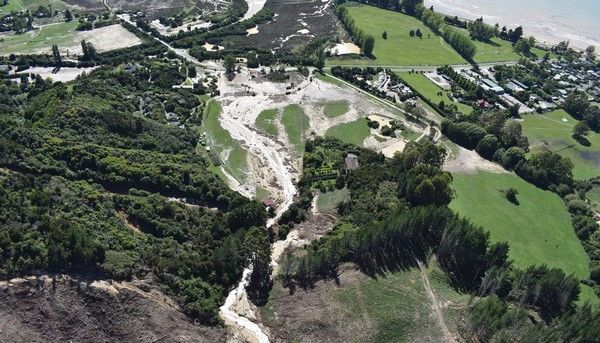
Debris flows are destructive flows of water, rock and soil that can travel long distances even on relatively gentle slopes They are more dangerous than ordinary floods as the solid material they carry can damage the environment, homes, farms and infrastructure (e.g. buildings, roads, bridges). The large amounts of sediment transported to rivers and the ocean also affects aquatic and marine ecosystems.
Recent debris flow events have highlighted the importance of understanding the susceptibility of harvested sites to debris flows.
Identifying catchments susceptible to debris flows will enable land and forest management operations to be optimised to minimise downstream impacts.
Scion has worked with the University of Canterbury to develop a debris flow model. They looked at areas where debris flows have occurred in the past and used factors such as watershed relief and area to predict debris flow and debris flood metrics and estimate how far debris flows could extend onto a fan or depositional area (runout distance). The data can be uploaded into Google Earth Pro (or any GIS).
The indicative debris flow and runout distance information can be used by landowners, councils and forest managers to make informed forestry harvesting and catchment management decisions during periods of critical operations such as harvesting.
If a catchment is assessed as susceptible to debris flows, it should be investigated, and risk management plans developed. These could include harvesting smaller areas or establishing permanent woody vegetation for erosion control. At the same time, areas with a lower level of debris-flow susceptibility could be harvested conventionally with confidence. The public will also benefit through reduced risk to the environment, infrastructure and private property.
The project has been running for a year with positive feedback from council staff and forestry companies. Research outputs are already being used to assess resource consent applications for forest harvesting.
“Working with Scion allowed us to access a combination of advanced spatial science and sound forest management thinking. Scion produced an easy-to-use map of potential debris flows to help guide forestry management decision-making and risk assessment. This kind of data-driven analysis is extremely valuable in our work to improve environmental outcomes in our region.” - Matt Oliver, Environmental Scientist for Land Resources, Marlborough District Council
Funders: Envirolink grant with Tasman and Marlborough District Councils
Collaborators: University of Canterbury, Tasman District Council, Marlborough District Council