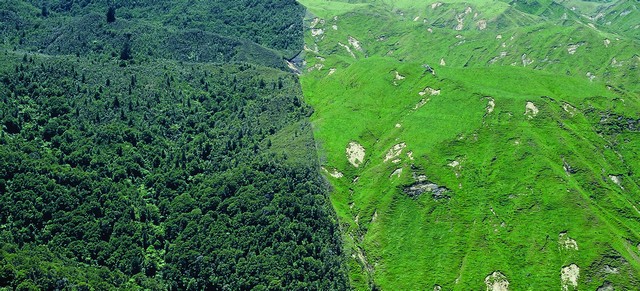
Combatting erosion with strategic afforestation

Strategic afforestation is a precise undertaking. The factors that influence where, why and what kind of forest is planted involve detailed information on environmental conditions, forest genetics and economics. Scion, in collaboration with PF Olsen, is working with the Hawke’s Bay Regional Council to identify where forests could fit into the regional landscape.
This project is a ‘real life’ application of Scion’s strategy ‘Right tree, right place, right purpose’ promoting an approach that would see landowners consider a range of factors before planting. This project aims to help landowners make informed decisions about planting, including which tree species is best for which purpose (e.g. planting for erosion, timber, carbon or products such as manuka honey), the environmental site conditions (e.g. slope, rainfall, temperature) and social considerations for nearby landowners and the wider catchment.
Why plant a forest?
The Hawke’s Bay Regional Council wants to know how forestry can help to reduce erosion in the region. With this clear purpose in mind, the project team has produced a map of the most erodible land across the region, identifying sites that lose more than 1,000 tonnes per km² of surface material annually. These sites are perfect to plant woody vegetation to reduce erosion, but each site has unique environmental conditions to take into consideration.
The biophysical considerations include rainfall, altitude, slope angle, aspect, soil type, erodibility, fertility and sediment loss. These factors, along with genetics and silviculture, will largely determine which species will perform best on the site (which will vary according to the purpose or desired outcome from planting). However, the species most likely to thrive might not necessarily serve the purpose for planting. For example, native species may be preferred for permanent forests and erosion control, or fast-growing exotic species might be favoured for carbon.
After identifying sites for potential afforestation across erodible landscapes of the Hawke’s Bay for commercial plantations and permanent forests, the next step was spatial mapping of tree species site suitability – for radiata pine, coastal redwoods, Cupressus lusitanica, Eucalyptus species, totara and manuka (for honey production).
Incorporating the economics
Forestry is a long-term investment and landowners need as much information as possible to de-risk their investment decisions.
Scion’s Forest Investment Framework (FIF) model takes a wide range of factors into account to provide landowners with more information. FIF combines information on forest productivity, infrastructure networks, planting and harvesting costs, the economic values of ecosystem services such as timber, carbon capture, erosion reduction, leaching reduction and habitats for native species. This, and other sources of information, are integrated in FIF to calculate outputs for the areas of interest.
The next step is to apply a social analysis to risk matrix. This will include interviewing farm foresters on their experiences with forestry and learning more about the financial drivers for farm foresters.
Conclusion
The project will help reduce the need for landowners to do extensive research on their own and aid them to make informed decisions with long-term environmental and social consequences in mind.
Projects like this could go on to help inform Te Uru Rakau policies on afforestation around New Zealand, ensuring, as always, that the right tree is planted in the right place for the right purpose.
For further information on this project contact
