Nelson Tasman storm damage rapidly detected using intelligence app
11 August
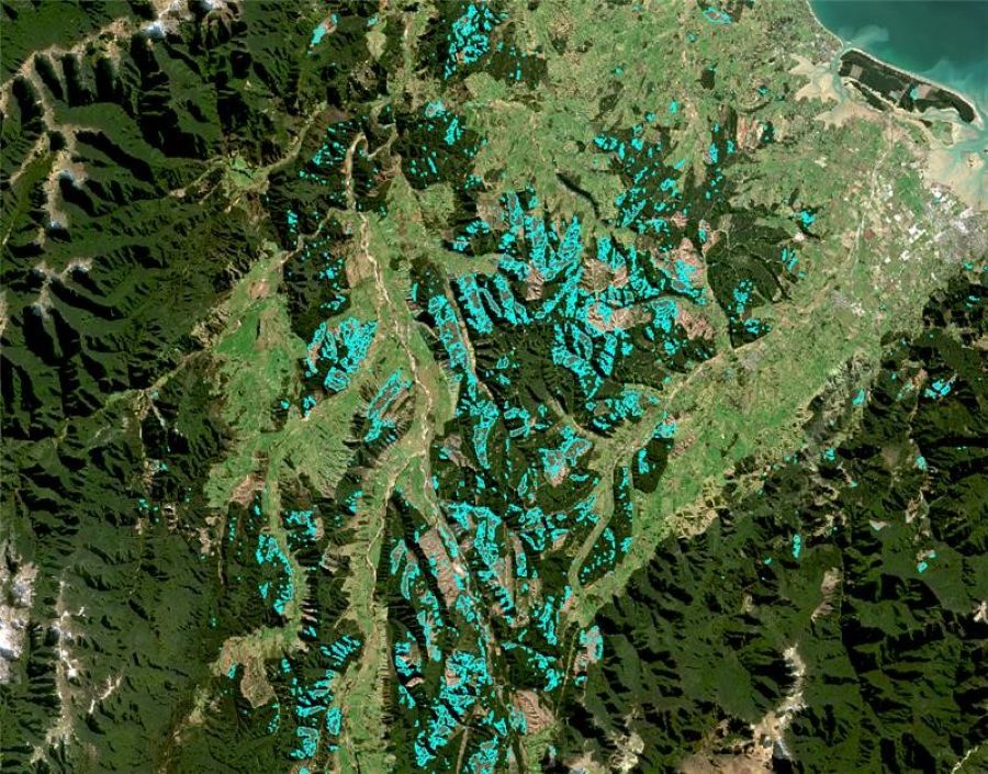
An AI tool using satellite imagery has been developed in the wake of the Nelson Tasman floods to deliver near real-time insights into forest damage.
The collaborative tool is helping the forestry sector and other land users assess impacts more quickly and plan recovery efforts with greater confidence.
The Scion Group of the Bioeconomy Science Institute (BSI) worked with Indufor on the tool’s development, to support recovery efforts. Using satellite data, the tool detects and maps storm-related damage to planted forests and the wider environment.
Using freely available Sentinel satellite imagery and radar, the team was able to detect windthrow and storm-related damage. The result: near real-time intelligence that helped forestry stakeholders understand the extent and location of the impacts.
Michael Watt, the Scion Group’s New Value Digital Forests and Wood Sector portfolio lead, says the lightweight app transforms complex remote sensing data into accessible insights, such as the estimated area and severity of affected forest blocks.
“The tool equips the forestry industry with timely insights, making tasks such as damage assessment, operational planning and processing logistics significantly easier.
“Councils, forestry companies and landowners can use the data we generate to quickly pinpoint impacted areas across the region. This supports rapid response and recovery across forests, croplands, orchards, farms and other land uses, as well as critical infrastructure.”
This technology was first operationalised following Cyclone Gabrielle in February 2023, when the Scion Group used it to assess storm damage across severely impacted areas within Gisborne and Hawke’s Bay. Indufor subsequently used similar methods to map windthrow throughout the entire Gisborne region within plantation boundaries identified using ForestInsights.
“Cyclone Gabrielle was the first real-world opportunity to deploy this system at scale following a natural disaster,” Michael says.
“Since then, the methods we use have been refined. The increasing frequency of events such as the Nelson Tasman storms shows how essential this rapid response capability is becoming.
"We now have validated models that can be deployed to rapidly detect and map regional windthrow from satellites, even under cloudy conditions.”